
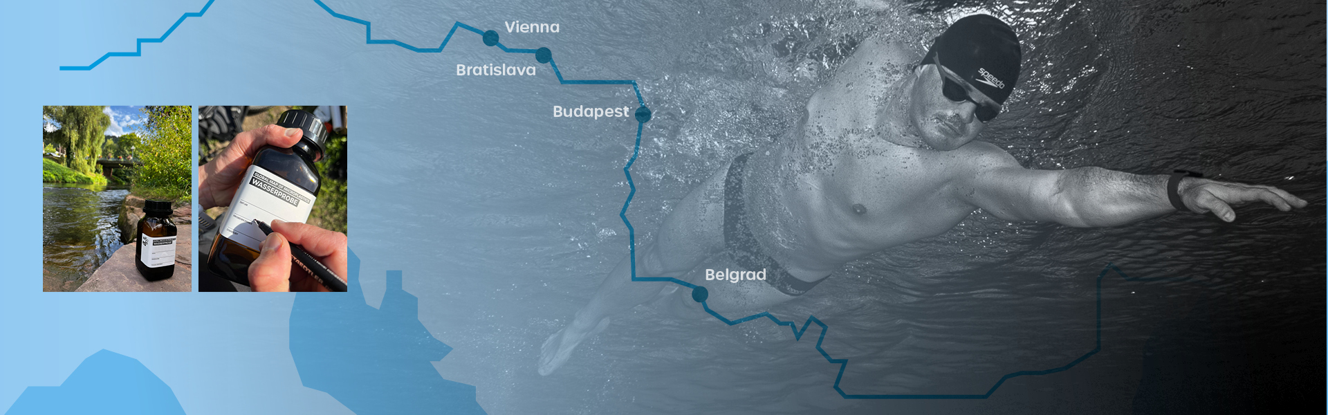
Danube 2850: microplastic mapping across 2,850 kilometres
From 4 July 2026 to 1 September 2026, samples were taken along the entire length of the Danube to test for microplastics: 2,850 kilometres through ten countries, more than 250 samples to a standardised protocol. It is the first continuous sampling of the river using consistent methodology across all riparian states.
Around 20 million people draw their drinking water from the Danube. What travels in it was, until now, an estimate.
The project is financed entirely through donations, sponsorship and corporate partnerships. Without those contributions the data would not exist.
As at 30 August 2026
Project figures
|
Route |
2,850 km, Donaueschingen to the Black Sea |
|
Countries |
Germany, Austria, Slovakia, Hungary, Croatia, Serbia, Bulgaria, Romania, Moldova, Ukraine |
|
Sampling |
4 July to 1 September 2026 |
|
Samples |
more than 250, standardised protocol, capture from 10 µm |
|
Laboratory analysis completed |
all samples down to Danube kilometre 1450, i.e. as far as the Serbian border — roughly half the route; validation under way |
|
Published and interpreted |
first 687 kilometres, 96 samples |
|
Data |
georeferenced and continuously updated in the Global Map of Microplastics |
|
Funding |
donations, sponsorship and corporate partnerships |
The swimmer
Dr Joseph Heß, an industrial engineer by training and an extreme swimmer, is swimming the route. In 2022 he swam the Rhine over 1,235 kilometres in record time, and before that the Elbe and the Strait of Gibraltar. His main occupation is as an authorised officer at a Berlin family business. The Danube is his largest undertaking to date.
The swim is not an end in itself: it makes the route accessible in one continuous effort and makes visible the knowledge gap the project is about.
Evaluation status
- Published: the first 687 kilometres from Donaueschingen to Aschach an der Donau, 96 samples. The full interpretation is in the press release First interpretation of the data from 687 river kilometres of 1 August 2026 (German).
- Analysed in the laboratory: all samples down to Danube kilometre 1450 — the stretch from the source through Germany, Austria, Slovakia and Hungary to the Serbian border, roughly half the total route. Validation of those data is under way. (The Danube kilometrage counts upstream from the mouth.)
Outstanding: the downstream sections. Evaluation and publication will follow; the full evaluation with all individual values appears at the close of the campaign.
In short, the first 687 kilometres show that contamination is not evenly distributed but concentrates at individual point sources — above all wastewater treatment plant discharges, impoundments, tributary confluences and low-flow river bends. Between those places, no microplastics were detectable in part. The detail, the placement within the international literature and the influence of the July 2026 low water are set out in the press release.
How microplastics are measured
Comparable values over hundreds of kilometres require a method that works identically everywhere. Our microplastic analytics use a fluorescence marker that selectively stains plastic particles so they can be distinguished from natural ones and counted automatically. The methodology is published in full (Analytica 2023, 4, 27; Microplastics 2023, 2, 334), as is the sampling strategy (Microplastics 2026, 5, 75). All work is listed under Publications.
What the data deliver, and what they do not
- These are snapshots along a route, not continuous monitoring. Microplastic concentrations vary considerably over time (Microplastics 2024, 3, 492). In return, however, we are providing the first comprehensive microplastic dataset for the Danube.
- Robust statements at a single point require repeat measurements: 21 large-volume samples for a ± 25 % margin of error at 95 % confidence (Microplastics 2026, 5, 75). For this reason, we have also increased the sampling intervals at specific locations.
- Particles from 10 µm upwards are captured. Nanoplastics are not represented, and detecting tyre wear is the subject of ongoing research. Not because we are unable to do so, but because the financial resources for it were not available.
What the data do deliver:
They show the spatial pattern across a large continuous stretch of river and provide a baseline for later comparison.
Why this project exists only with funders
Continuous sampling across 2,850 kilometres and ten countries fits no conventional funding scheme. There is no fund and no programme to apply to. Danube 2850 is carried entirely by donations, sponsorship and corporate partnerships.
What that means in practice: every funded stretch is one more measuring point on the map. The published 687 kilometres, and the sections currently being validated, exist because people and companies decided to back them. Without them these data would not exist.
*[List funders and partners with their role; agree the namings in advance.]*
This is not only true of the Danube. School classes taking their own measurements, water days at rivers and the planned complete survey of Lake Constance all depend on the same condition. Every project financed exclusively through donations and sponsorship is listed under Spread Love Not Microplastics.
THANK YOU to our Partners in Mission — United in Accelerating Impact







How you can contribute. Either a donation with a tax receipt or sponsorship with an invoice; we are recognised as a non-profit. Details on structure and use of funds are under Transparency. Donate directly or get in touch — one sentence is enough.
Newsroom
- 26 June 2026 — The Danube as chief witness: first full measurement shows Europe's microplastic load (German)
- 08. July 2026 — The investigation along the Danube has begun — first traces from Brigach and Breg secured (German)
- 1 August 2026 — Microplastics in the Danube: first interpretation of the data from 687 river kilometres (German)
- 11 August 2026 — Drought 2026: dilution is not treatment (German)